×The lizmap project CALENDRIER_CHASSE_FDCRECY does not exist !
Environnement
-
- Information
- Titre
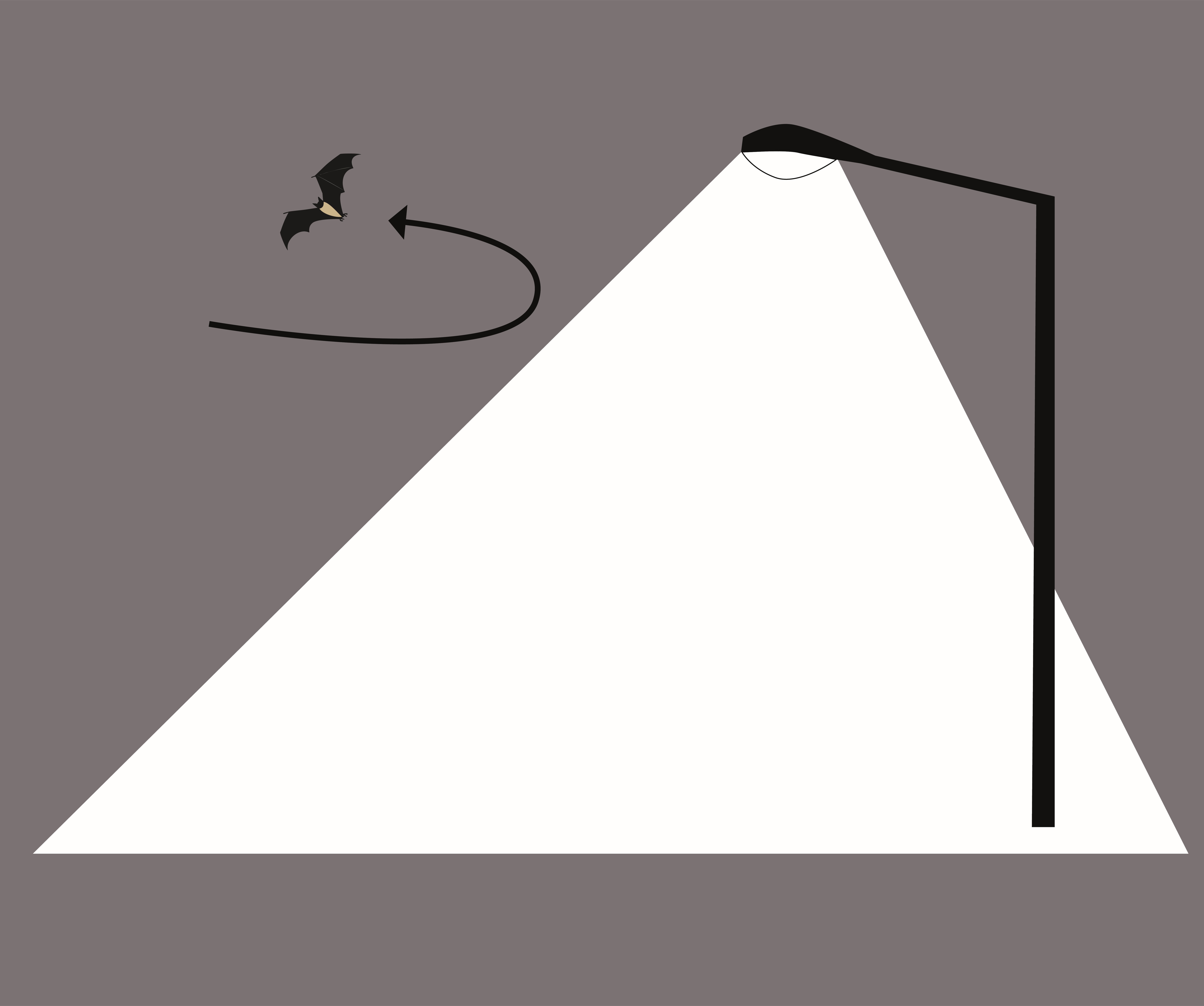
- Points lumineux proches des zones d'enjeux naturels
- Résumé
- Carte présentant les résultats de l'étude de la Trame Noire du Parc naturel régional Baie de Somme - Picardie maritime
- Projection
- EPSG:2154
- Emprise
- 587695.17570000002160668, 6990281.74419999960809946, 635762.09550000005401671, 7027273.75519999954849482
- Service WMS
- WMS Url
- WMTS Url
-
Haies et enjeux naturels de Picardie maritime en lien avec les lignes aériennes du réseau Enedis
Voir la carte
Description
- Information
- Titre
- Haies et enjeux naturels de Picardie maritime en lien avec les lignes aériennes du réseau Enedis
- Résumé
- Cartographie des haies recensées et des enjeux du patrimoine naturel en Picardie maritime en lien avec les sites naturels et les lignes électriques du réseau exploité par Enedis.
- Projection
- EPSG:2154
- Emprise
- 581234.36199999996460974, 6982020.37430000025779009, 655876.00260000000707805, 7037181.72740000020712614
- Service WMS
- WMS Url
- WMTS Url
Paysage
-
- Information
- Titre
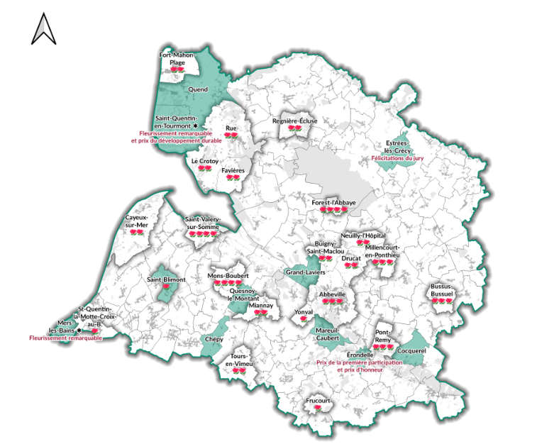
- Villes et villages fleuris accompagnés par le Parc
- Résumé
-
- Projection
- IGNF:LAMB93
- Emprise
- 543024.64126278343610466, 6957570.74035090673714876, 676435.09442005585879087, 7056388.70611888635903597
-
- Information
- Titre
- Itinéraires des villages-courtils
- Résumé
-
- Projection
- EPSG:2154
- Emprise
- 615045.13356852193828672, 7002908.07276789378374815, 634872.98641744477208704, 7016265.96014250535517931
-
- Information
- Titre
- Lectures paysagères et balades urbaines
- Résumé
-
- Projection
- EPSG:2154
- Emprise
- 574161.3084871165920049, 6986409.77490144781768322, 644617.31695606047287583, 7034036.12918798439204693
-
- Information
- Titre
- Villages courtils du PNR
- Résumé
-
- Projection
- EPSG:2154
- Emprise
- 580831.66859999997541308, 6978036.24700000043958426, 658230.80400000000372529, 7031806.81919999979436398
Le Parc naturel régional
-
- Information
- Titre
- Agriculture
- Résumé
-
- Projection
- EPSG:2154
- Emprise
- 570145.59649999998509884, 6972168.75930000003427267, 665312.66830000001937151, 7048589.35259999986737967
-
- Information
- Titre
- Avis document cadre Chambre d'agriculture et parking - photovoltaïque au sol et ombrières
- Résumé
-
- Projection
- EPSG:2154
- Emprise
- 570145.59649999998509884, 6972168.75930000003427267, 665312.66830000001937151, 7048589.35259999986737967
-
- Information
- Titre
- Eaux intérieures et littoral
- Résumé
-
- Projection
- EPSG:2154
- Emprise
- 576742.98421170050278306, 6978242.67284441646188498, 648793.71684975014068186, 7035477.33933436032384634
-
- Information
- Titre
- Sites naturels - propriété et gestion
- Résumé
- Données du Conservatoire botanique national de Bailleul
- Projection
- EPSG:2154
- Emprise
- 570145.59645154792815447, 6972168.75928068347275257, 665312.66829167841933668, 7048589.35264778323471546
-
- Information
- Titre
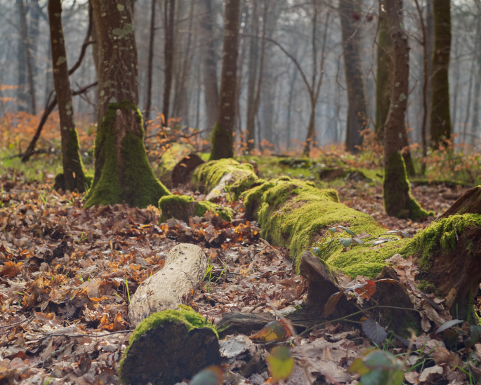
- Carte de la forêt de Crécy - Natura 2000
- Résumé
-
- Projection
- EPSG:2154
- Emprise
- 601139.04240000003483146, 7005823.47449999954551458, 636633.55799999996088445, 7025866.87339999992400408
-
- Information

- Titre
- Territoire et grands projets de Baie de Somme 3 Vallées
- Résumé
-
- Projection
- EPSG:2154
- Emprise
- 571558.8521197285, 6982136.9175, 647187.1478802715, 7031906.182500001
-
- Information
- Titre
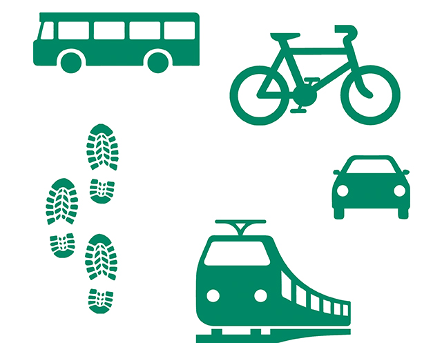
- La mobilité sur le territoire du Parc naturel régional
- Résumé
-
- Projection
- EPSG:2154
- Emprise
- 582379.89890000002924353, 6987374.11019999999552965, 650833.22190000000409782, 7033191.90950000006705523
-
- Information
- Titre
- Propositions de plantation Trame verte et Chemins ruraux
- Résumé
- Consultation des propositions de plantations dans le cadre de l'expérimentation de renforcement de la Trame Vert le long des chemins ruraux
- Projection
- EPSG:2154
- Emprise
- 584328.6023999999742955, 6985579.86249999981373549, 638337.1476000000257045, 7022167.63750000018626451
-
- Information
- Titre
- Publications du Parc naturel régional sur les communes et leurs patrimoines
- Résumé
- Carte des documents publiés dans le cadre du Parc naturel régional.
- Projection
- EPSG:2154
- Emprise
- 598623.31389999995008111, 6995499.78699999954551458, 636336.30110000004060566, 7020384.41949999984353781
-
- Information
- Titre
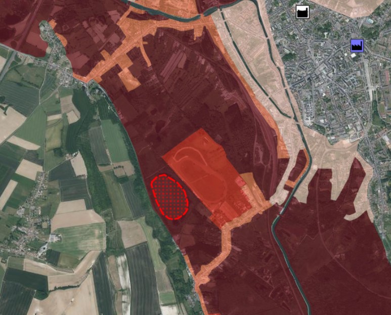
- Etude de la Trame Noire du Parc naturel régional
- Résumé
-
- Projection
- EPSG:2154
- Emprise
- 583968.6143999999621883, 6974889.72769999969750643, 649810.7101000000257045, 7031385.15369999967515469
-
- Information
- Titre
- Zonages, servitudes et autres périmètres
- Résumé
- Dessinez le polygone de votre projet et découvrez s'il est situé dans un zonage règlementaire (Natura 2000, Ramsar, Monument Historique, PPRI, site classé...)
- Projection
- EPSG:2154
- Emprise
- 570145.59645154792815447, 6972168.75928068347275257, 665312.66829167841933668, 7048589.35264778323471546
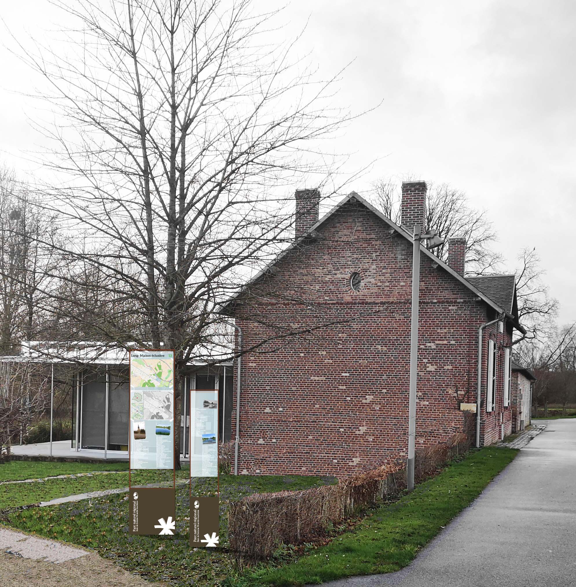
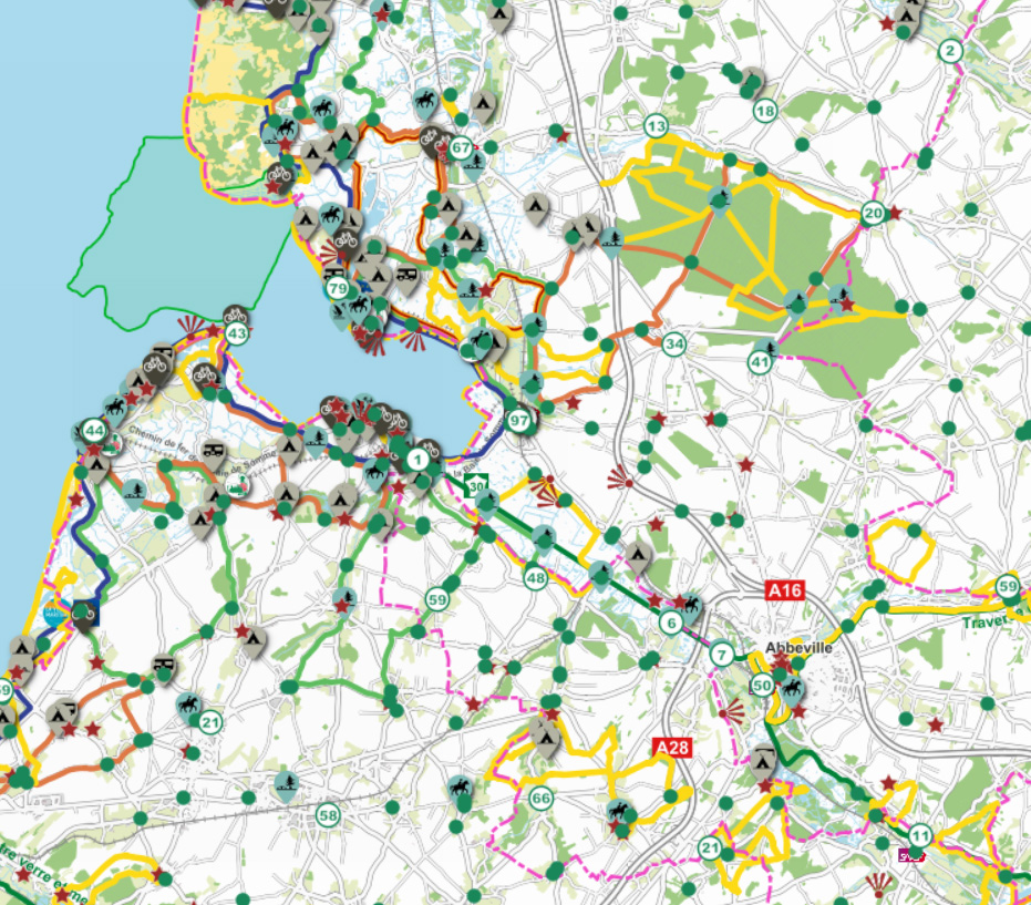
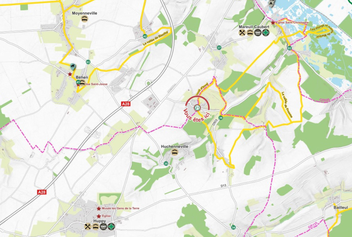
Réseau Points Nœuds
-
- Information
- Titre
- Concertation pour l'implantation des totems du Réseau points nœuds
- Résumé
- Placez et déplacez les totems du Réseau Point Nœud afin de décider de leur implantation.
- Projection
- EPSG:2154
- Emprise
- 576027.49225766118615866, 6983052.46290047466754913, 649841.63427402242086828, 7032105.79439112544059753
-
- Information
- Titre
- Carte contributive du réseau Points Nœuds
- Résumé
- Projet collaboratif autour de la cartographie touristique du Réseau points nœuds. Les utilisateurs autorisés peuvent ajouter des commentaires ou de nouveaux points d'intérêts à la carte.
- Projection
- EPSG:2154
- Emprise
- 576742.9841999999480322, 6978242.67279999982565641, 648793.71680000005289912, 7035477.33930000010877848
-
- Information
- Titre
- Carte du réseau Points Nœuds pour impression
- Résumé
-
- Projection
- EPSG:2154
- Emprise
- 576742.98421170050278306, 6978242.67284441646188498, 648793.71684975014068186, 7035477.33933436032384634